|
NEW: COVID RESOURCES FOR RESIDENTS OF CREST, DEHESA, HARBISON CANYON AND GRANITE HILLS
NEW: Check your home's risk of flooding with FloodFactor |
Reducing wildfire risk must be at the center of our COMMUNITY planning
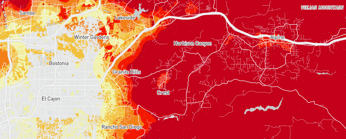
This map, generated by the US Forest Service Wildfire Risk to Communities tool, tells the story. For the communities of Crest, Dehesa, Harbison Canyon and Granite Hills, wildfire risk reduction must be at the center of our community planning. Numerous communities in fire prone areas are using community and land use planning tools as part of a comprehensive strategy to make homes and neighborhoods safer.
Background photo taken from the Crestridge Ecological Reserve at sunset, looking west.
Paid for by Nehring for Crest Planning Area 2020